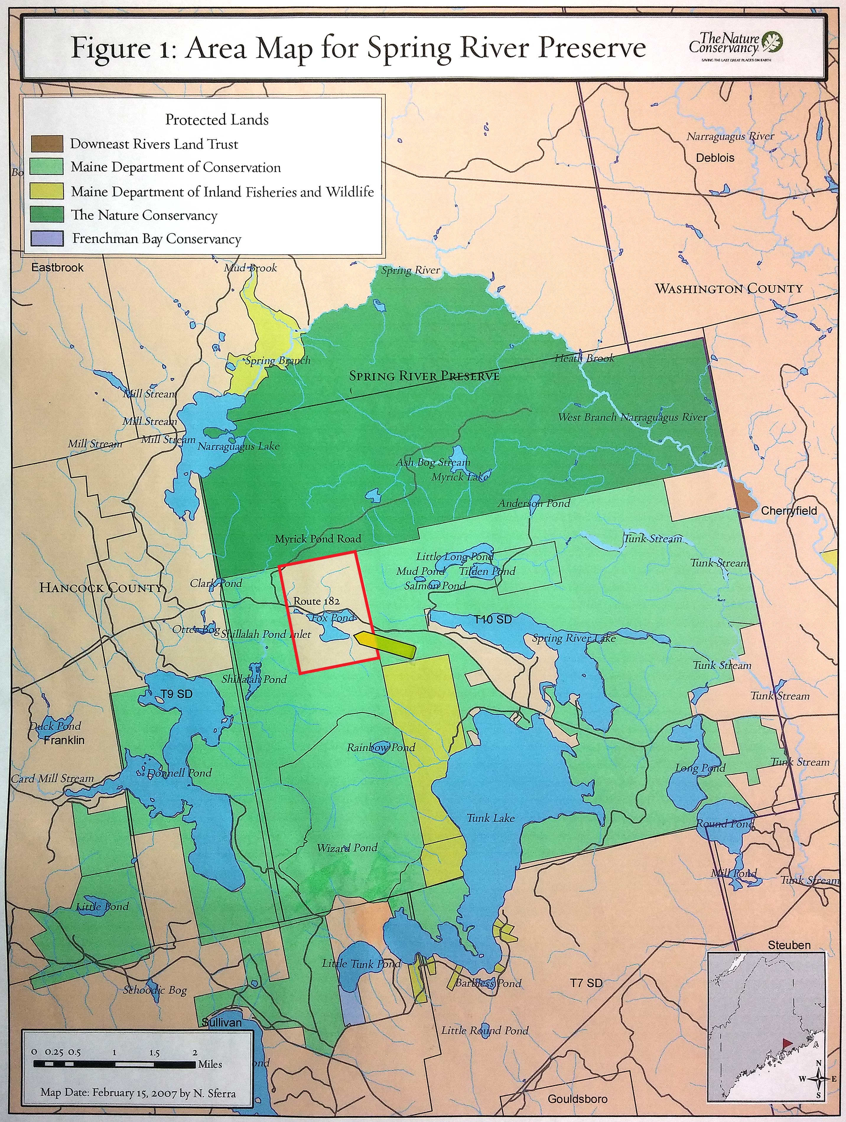
Nature Conservancy Land Map – Click to enlarge.
Fox Pond is 45 minutes from Bangor International Airport, and 25 minutes from Hancock County – Bar Harbor Airport. Both are served by commercial and private air traffic.
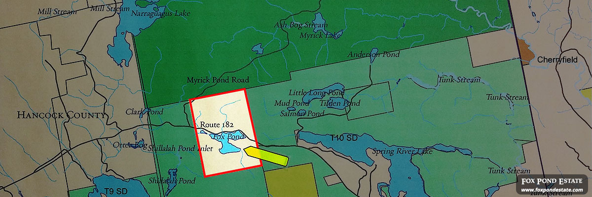
Nestled in a small valley between Tunk Mountain to the north and Catherine, Caribou and Schoodic Mountains to the south, Fox Pond is situated along the old stage coach road (Ellsworth to Machias). This road is now designated Maine Scenic By-Way, State Road 182. Fox Pond is at latitude 44° 37.5’ North by longitude 068° 06.5’ West. It is mid-way between the two small towns of Franklin and Cherry Field.
In the Maine Atlas and Gazetteer (Delorme), Fox Pond is found on Map 24, Grid D-5. In Rand McNally’s 52nd Road Atlas, it’s found in grid designation D10 on the state land known as Township 10 S.D.
Fox Pond lies in the center of the fabled “Black Woods” also known locally as “BlackWoods.” See History Legends & Lore.
Directions:
From all points south in New England, take I-95 north and cross into Maine. I95 north becomes I95/Maine Turnpike. Continue on I95/Maine Turnpike north, pass Portland, pass Augusta where the Maine Turnpike ends, but continues north as I95 toward Bangor.
At Bangor take exit 182 toward U.S. Route 1A – Ellsworth / Bar Harbor. In Ellsworth US Route 1 joins Route 1A and 3. Follow US Route 1 north at a McDonalds restaurant. Follow US Route 1 north approximately 5 miles. Turn left onto State Route 182 (also called the Franklin Rd). At about 6.3 miles you will pass the Franklin Trading Post. Continue on Route 182 (it will now become the Blacks Woods Rd). Travel another 7.3 miles to Fox Pond. Pass the pond (about ¼ mile) and arrive at FoxLodge Lane on your right. You will need an appointment as the gate is normally locked.
Interactive Map